The rapid development of El Niño in 2026 is expected to significantly alter weather patterns across the globe. This phenomenon is evolving faster and stronger than initially projected, with implications for millions.
A powerful oceanic Kelvin wave has intensified, effectively ending the multi-year La Niña influence that has dominated recent years. The ENSO (El Niño Southern Oscillation) cycle alternates between these warm and cold phases, impacting global weather patterns every few years.
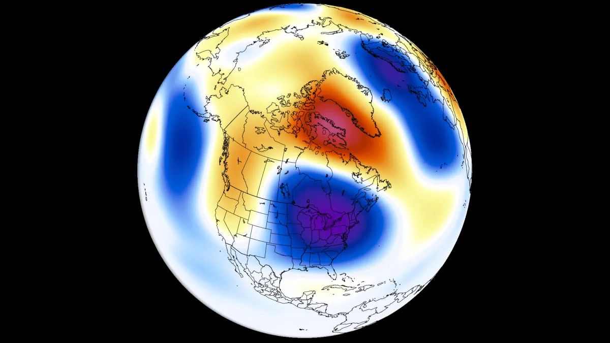
Current forecasts indicate a very high chance for a Super El Niño to develop by the second half of 2026. The latest ECMWF and UKMO models show a stronger El Niño signature in Summer 2026 pressure patterns than earlier updates predicted.
Expected Weather Changes:
- A low-pressure area is forecast over eastern Canada and the northeastern United States during Summer 2026.
- Above-normal temperatures are anticipated across the northwestern United States and western Canada.
- Increased rainfall is predicted over the western, central, and northeastern United States, as well as the Midwest and southeastern Canada.
- Conversely, less precipitation is expected over the far southern United States and across southern and central Canada.
This shift could lead to significant disruptions in agriculture, water supply, and even increase risks of natural disasters such as flooding or droughts. But what does this mean for everyday life? It means preparing for a summer that may not resemble any other in recent memory.
The implications of El Niño extend beyond immediate weather changes; they can affect global food supplies and economic stability. As nations respond to these shifts, cooperation will be crucial.
However, uncertainties remain. Officials have not confirmed how strong this Super El Niño might become or its precise impacts on specific regions. The situation is fluid, with updates expected as we approach summer.